The fragile horse-powered ferry in Burlington Bay is the only archaeologically studied example of a turntable “team-boat,” a once common North American vessel type. Animal powered vessels were introduced into North America in 1814. They became a popular form of transportation for short-distance river and lake crossings, until the middle of the 19th century, when they were surpassed by the increasing use of steam power.
Lake Champlain’s long, narrow shape created the need for many ferry crossings between Vermont and New York, crossings that were ideally suited to horse ferries. The use of horse ferries on the Lake appears to have peaked in the 1830s and 1840s.


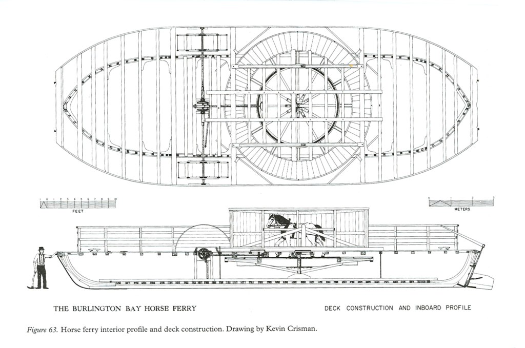
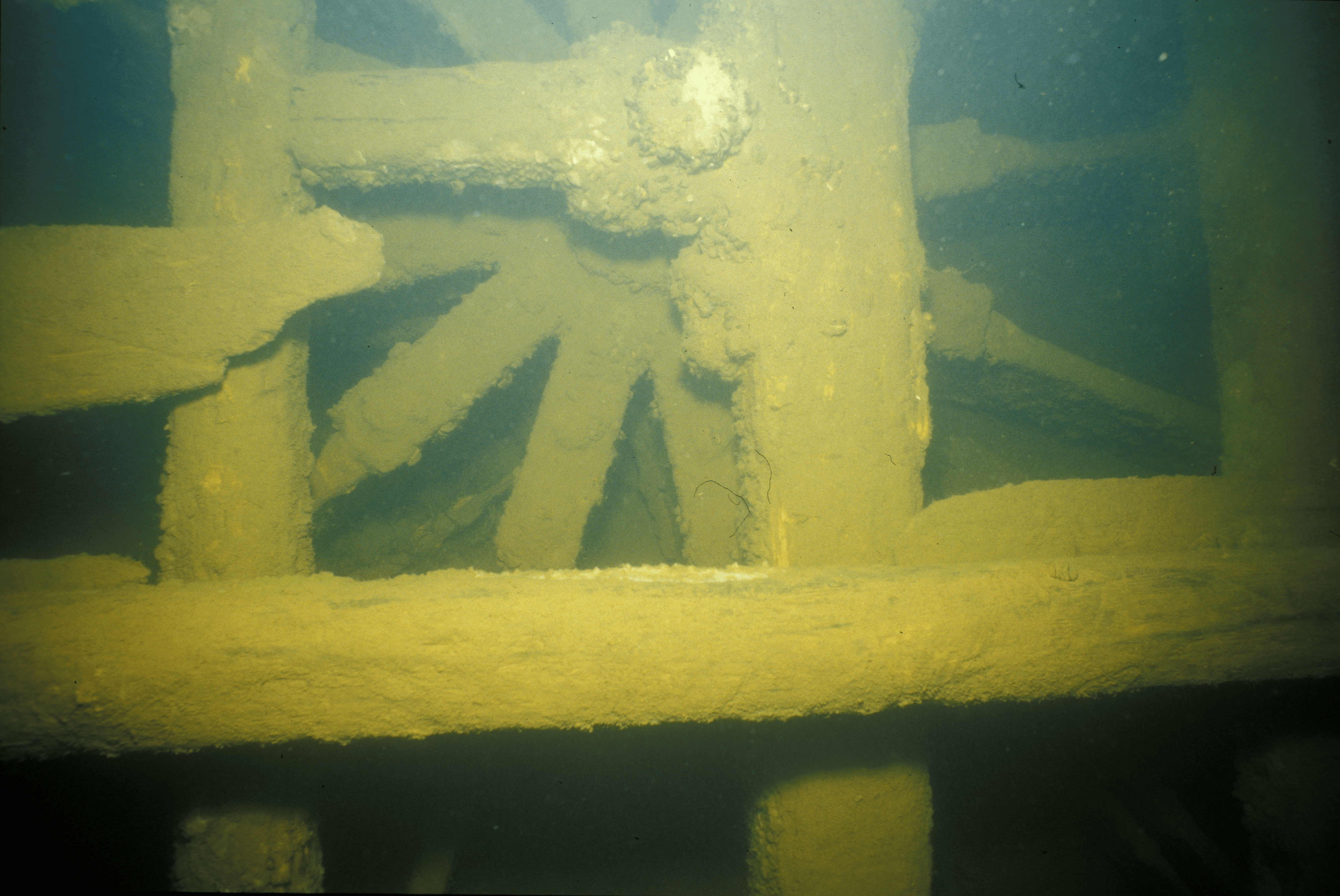
Line drawing of the horse ferry and Shaft and paddlewheel
The Burlington Bay Horse Ferry was discovered in the fall of 1983 during a side-scan sonar survey. The identity and date of construction have not yet been determined. Continued study of this unique vessel may provide more clues to her name and date of sinking.
A working 1/2-size model of this vessel’s horse-power system can be seen at our museum. More information about this wreck can be found in the 1998 publication When Horses Walked on Water: Horse-Powered Ferries in Nineteenth-Century America, by Kevin Crisman. Read more about this fascinating wreck, (follow the links from the Virtual Museum of Nautical Archaeology, to Lake Champlain Projects), from the Institute of Nautical Archaeology.
Features of Interest
- Size of wreck: 63′ long, 23′ wide.
- The horizontal flywheel and gear shaft are visible amidships.
- The two paddle wheels are perhaps her most spectacular feature. The iron hubs and oak spokes are deteriorated but intact; the paddle blades are missing. The paddle wheels are easily damaged—please avoid touching them.
Diving Information
- Experience level: Intermediate
- Depth of water: 50′
- This vessel is weak and easily damaged. Control your buoyancy. Do not use any part of the vessel to support your weight.
- Stay off the bottom to avoid low visibility conditions. Avoid contact with the fragile shipwreck.
Location
- 44 29′ 05.892″N 073 14′ 34.87″W
- Approximately 2/3 of the way northwest from the north end of the Burlington breakwater to Lone Rock Point.
